COFFEENEURING OFFICIAL BUSINESS: If you were a Coffeeneuring Challenge finisher or honorable mention, please send me your snail mail address via my gmail address OR the “Contact” page so that I may send out your PRIZES!
Earlier this week, I received a note from a North Carolina randonneur and blogosphere buddy. Andy had used the Coffeeneuring Challenge data as the basis for his on-line tutorial, “How to plot points on a map using Google Fusion Tables”
The result of his plotting is a world map that shows the home cities of all 62 participants.
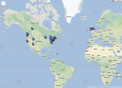
Coffeeneuring + Fusion Tables = World Coffeeneuring Map.
Awesome? Yes, awesome!
The world coffeeneuring map is easy to review and also gives the reader a fairly specific visual of the geographic dispersion of coffeeneurs. It also helped me see why Mike T. of Edmonton, Alberta, completed his final coffeeneuring ride using studded tires. I did not realize that Edmonton was that far north.
In perusing Andy’s blog entry, I know it would take me some time to create my own coffeeneuring map, but it is possible that I could shift from using the magic coffeeneuring map to the world coffeeneuring map.
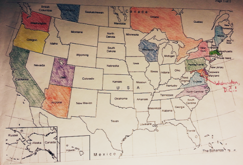
It will be hard to give up the colored pencils, though, so I will likely use both visual aids.
Thank you, Andy, for creating the world coffeeneuring map. I look forward to using your tutorial for next year’s challenge! (Or I might just email you to help me!)

Comments & questions welcome – moderated for trolls and spam.